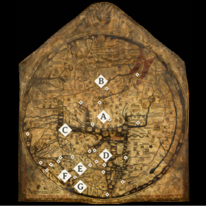
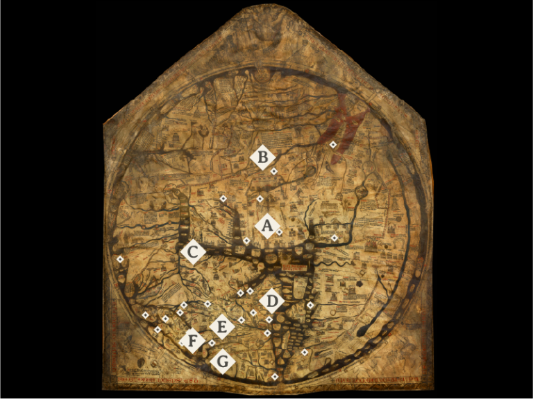
Hereford Mappa Mundi
The Hereford Mappa Mundi, dating to c. 1300, is the largest known map (1.59 x 1.34 meters) to have survived from the Middle Ages, and has its home at Hereford Cathedral in England. The map represents the world as medieval people understood it, and follows the T-O map schema, in which east—not north—is at the top. At the center of the world is Jerusalem, which speaks to the importance of the holy city in the medieval mind. Icons marking important cities and landmarks, both historical and legendary, punctuate the map. Elephant and unicorn alike wander around in different parts of the world, and depictions of mythical peoples line the southern edge of the African continent. Hereford, a destination that usually would not be included on medieval mappae mundi, can be found marked in the British Isles. Presiding over the world is Christ of the Last Judgement.
- Jerusalem
- Tower of Babel
- Constantinople
- Rome
- Paris
- Canterbury
- Santiago de Compostela
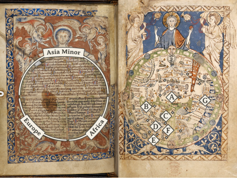
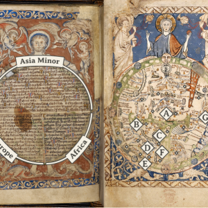
Psalter Maps
The Psalter World Map and List Map, created c. 1262-1300, are two back-to-back full-page illustrations found in a psalter, now conserved at the British Library (Add MS 28681). Although much smaller than the Hereford Mappa Mundi (measuring only 170 x 130mm), the Psalter World Map (f. 9r) shares many similarities with the Hereford map, including the T-O plan and the inclusion of historical, biblical, and mythical elements. The List Map on the reverse page (f. 9v) includes written descriptions of important cities and regions in the three known continents at the time. Much like how the Hereford map is crowned by Christ at the Last Judgment, the Psalter World Map depicts Christ presiding over the world, while the Psalter List Map shows Christ holding up the world in His arms.
- Jerusalem
- Constantinople
- Rome
- Paris
- Ireland
- Barcelona
- The Barns of Joseph (Pyramids of Giza)
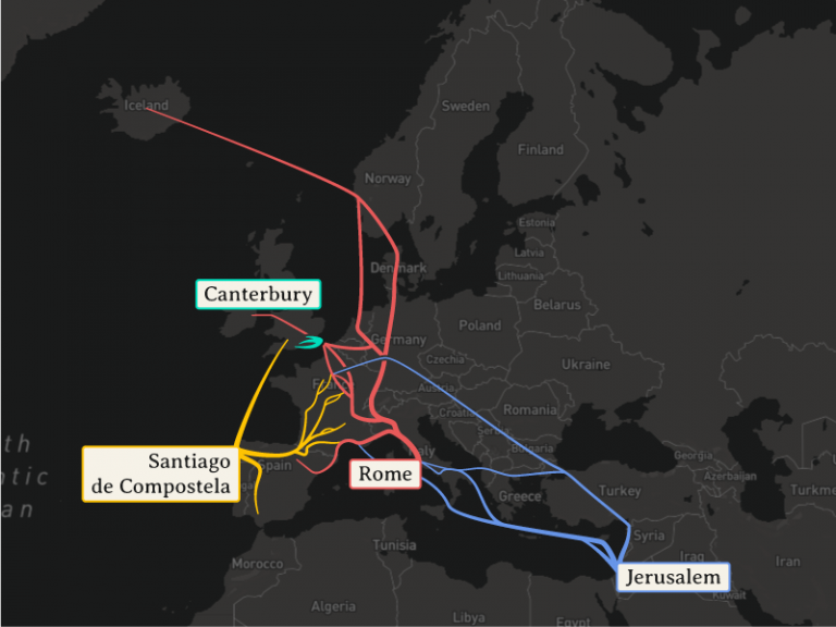
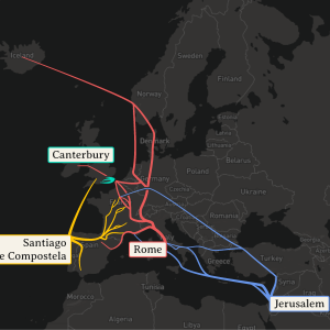
Modern Map
This is the map we are used to seeing today, overlaid with medieval pilgrimage routes that lead to Jerusalem (blue), Rome (red), Santiago de Compostela (yellow), and Canterbury (green). The paths that modern pilgrims travel still have their roots in these medieval routes.
Visit the site in desktop view for an interactive modern map!